| Vector | ||
| Polyline |
|
A spatial file. Contains only polylines. Green= shapefile; Blue= feature class |
| Polygon |
|
A spatial file. Contain only polygons. Green= shapefile; Blue= feature class |
| Point |
|
A spatial file. Contains only points. Green= shapefile; Blue= feature class |
| Triangulated Irregular Network (TIN) | A vector representation of elevation over a landscape | |
| Network Dataset | Network Datasets are used to create complex analysis of transportation networks utilizing detailed attributes regarding how each feature interacts with the others. Green= outside geodatabase; Black= inside geodatabase |
|
| Raster | ||
| Raster (Image file) | Any image file. May or may not be associated with spatial data. Yellow= outside geodatabase; Blue= inside geodatabase |
|
| Organization | ||
| Geodatabase | The biggest “container” for spatial data. Can contain vector or raster data. | |
| Feature Dataset | A container for similar vector files. Can contain points, lines, or polygons (not rasters). | |
| Raster Catalog | Collections of rasters which are organized and defined by a key. Can not contain vectors. | |
| Topology | A GIS topology is a set of rules and behaviors that model how points, lines, and polygons share coincident geometry. | |
| Tables | ||
| Excel Table | Excel table. Contains non-spatial data. Often is ‘joined’ or ‘related’ to spatial data. | |
| Other Data Table (various kinds) | Tables without the specific .xls file extension. May contain non-spatial numeric or text data, or may contain numeric data associated with a spatial object. Tables are not specifically spatial, but often make up a crucial part of spatial data. | |
| Other Icons | ||
| Text File | Text files are used for any sort of textual or paragraph data storage, such as metadata (information about the spatial data) or methods/other notes. While ArcGIS can read text files, they do not serve any sort of analysis purpose for us. | |
Accessibility Options
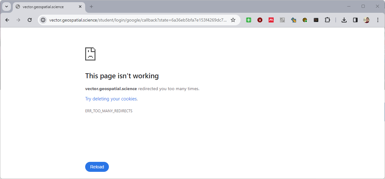
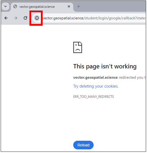
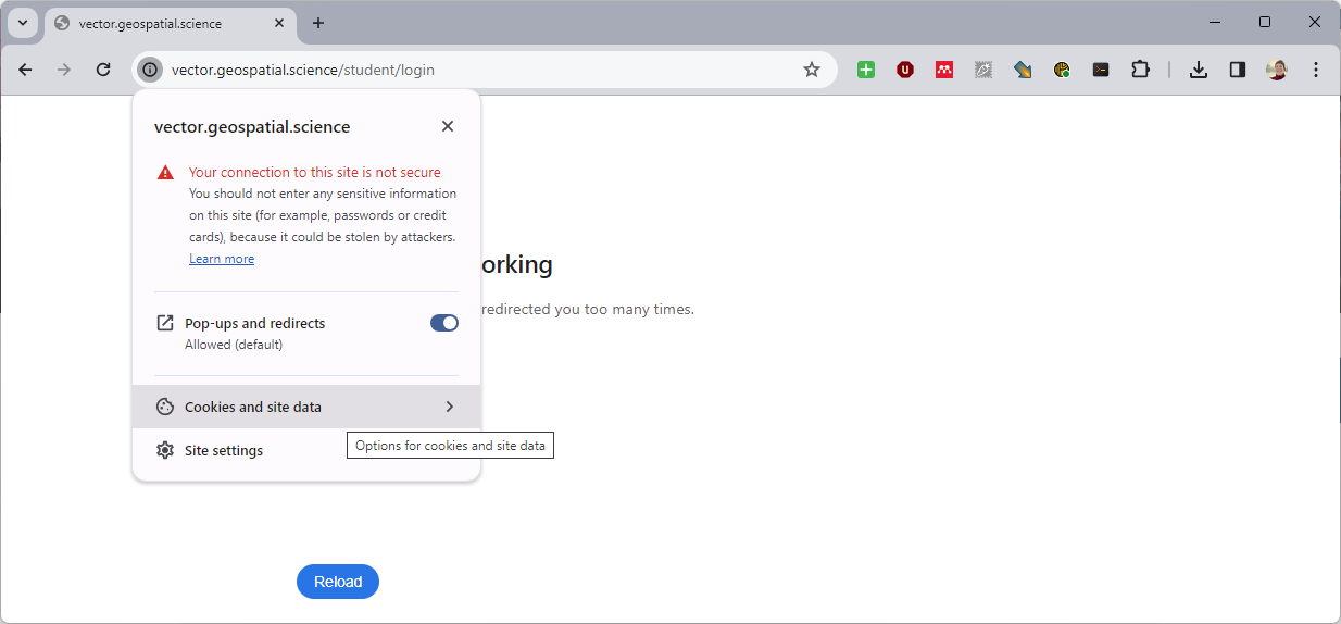
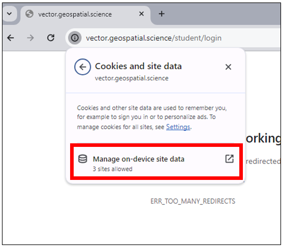
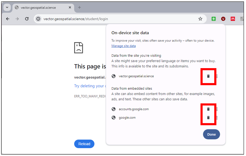
Login Redirect Error Workaround
If Chrome is saying: "vector.geospatial.science redirected you too many times. Try deleting your cookies. ERR_TOO_MANY_REDIRECTS." after clicking the Login button, do the following to fix it.
|  |
|  |
|  |
|  |
|  |