
Custom User Menu

  • Log In
Home

Main navigation

  • Home
      • Table of Contents
      • How to Highlight and Take Notes
      • Acronyms
      • Figures
      • Glossary
      • File Icons
      • Footnotes and References
      • Supported Coordinate Systems
      • Chapter One Title Page
      • Section One - Introduction
      • Section Two - What is GIS?
      • Section Three - Why Do We Need A GIS?
      • Section Four - Putting it all Together: An Example
      • Section Five - Uses of GIS
      • Section Six - History of GIS
      • Chapter Two Title Page
      • Section One - Introduction
      • Section Two - Geodesy
      • Section Three - Mathematically Measuring the Earth
      • Section Four: Latitude and Longitude - One Example of a Geographic Grid
      • Section Five: Geodetic Datums: Combining Reference Ellipsoids and Geoids
      • Section Six: Geographic Coordinate Systems
      • Section Seven: Projection Methods
      • Section Eight- Projected Coordinate Systems
      • Section Nine: Just a Few Extras
      • Chapter Three Title Page
      • Section One - Introduction
      • Section Two - Vector Data
      • Section Three - Raster Data
      • Section Four - Discrete and Continuous Data
      • Section Five - Data Tables
      • Section Six - Introduction to Attribute Tables
      • Chapter Four Title Page
      • Section One - Introduction
      • Section Two - Data Models
      • Section Three - Meet ArcGIS Pro Catalog View
      • Section Four - Meet ArcGIS Pro Maps and Layouts
      • Section Five - What Are Relational Databases and Geodatabases
      • Chapter Five Title Page
      • Section One - Introduction
      • Section Two - Attribute Tables: An Overview
      • Section Three - Attribute Tables Basics
      • Section Four: Selecting Data in ArcMap - The Basics of Making Selections
      • Section Five: Using Selected Data
  • Toolbars
  • Windows Operations

How to Highlight and Take Notes

Breadcrumb

  • Home
  • Introduction To GIS
  • How to Highlight and Take Notes
  1. Visit https://hypothes.is/

  2. Create a new account with the Get Started button

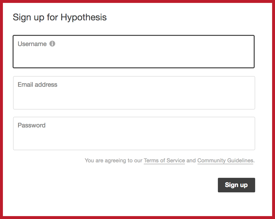
  3. Sign up for a Hypothesis account:

  1. Get the Chrome extension:

    • Go to web.hypothes.is/start and click add-on for Chrome. A window will pop up and prompt you to install the extension. If the window does not appear, try disabling your ad blocker or enabling pop-ups.

      The Hypothesis icon will automatically appear in your toolbar.

      (If you prefer, you can install the add-on through the Chrome store.)

      3. Go Forth and Annotate:

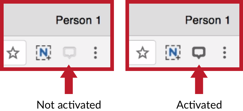
      Navigate to a webpage that you would like to annotate. Make sure the Chrome extension is activated – if it’s not, click the greyed-out button in your toolbar:

      To see existing annotations, either open the sidebar or click on highlighted text within the body of the document. If you have Hypothesis activated now, you can practice on this sentence.

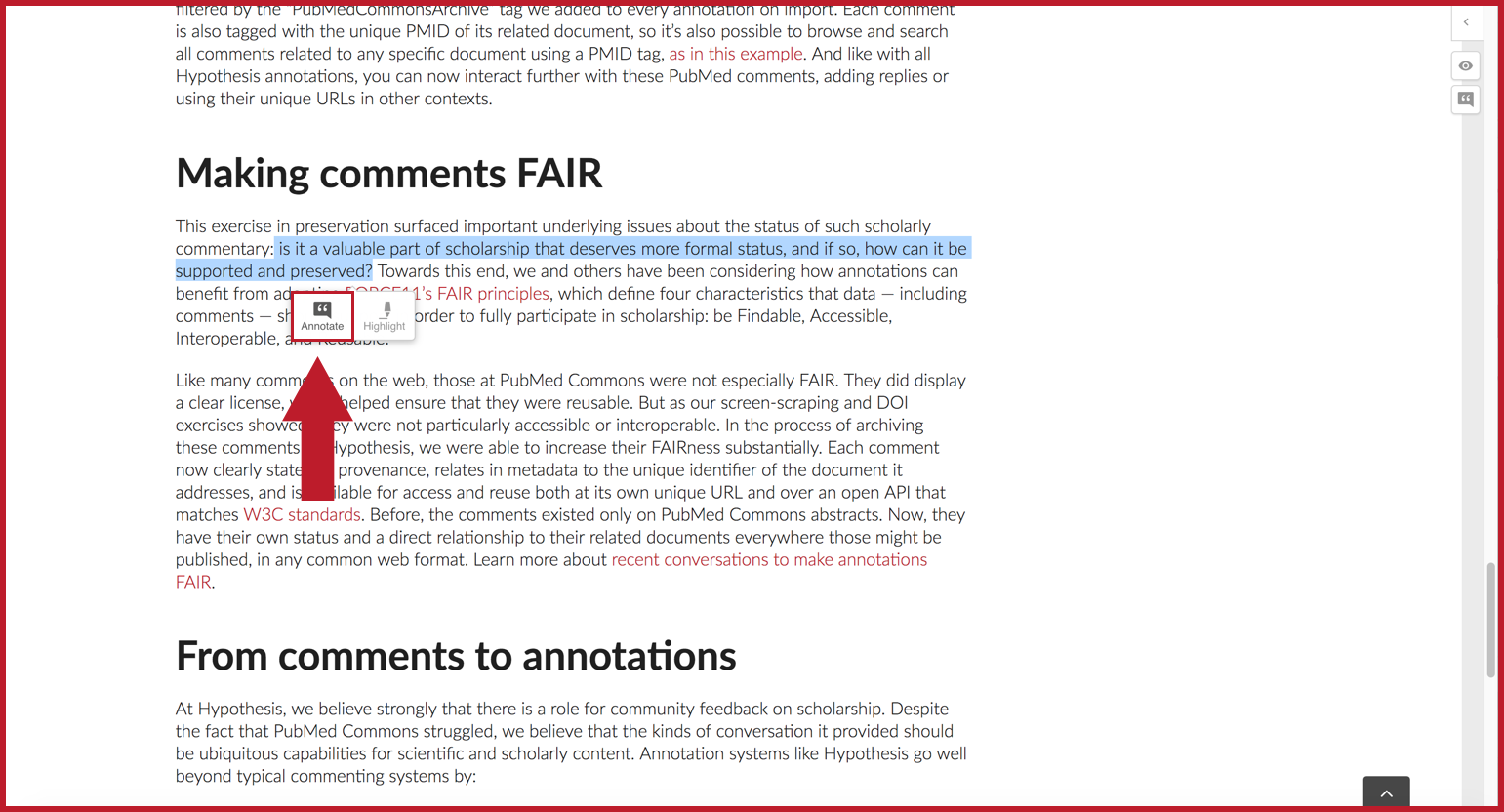
      To create your own annotation, select some text and click Annotate on the adder that pops up:

      Enter your annotation content in the composition window and click Post Only to Me


  • <   Chapter One - History and Scope of GIS Chapter One
  • Up
  • Section One - Introduction Section One   >